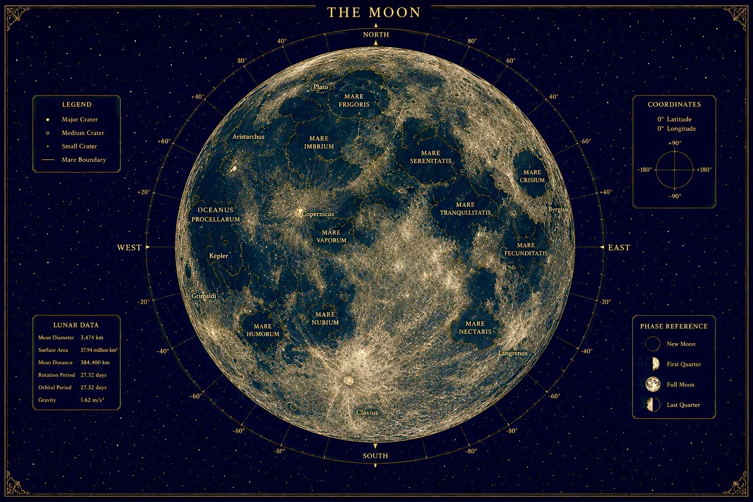
Explore the face of the Moon that always points toward Earth. Click any glowing marker on the lunar surface below to learn the name, type, and story of a major sea or crater — from the Apollo 11 landing site in the Sea of Tranquility to the brilliant rayed crater Tycho.
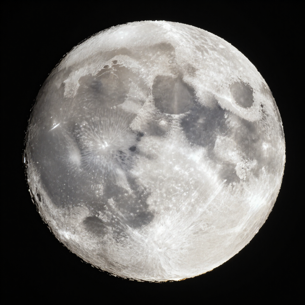
Hover or drag across the moon to zoom in — hover a glowing dot to learn about a feature.
Pick a lunar feature
Hover or click any glowing dot on the Moon to see its name, type, and a short description here.
Teachers: free printable worksheet
Free Classroom Poster
A printable portrait poster of the Moon’s near side, with every major sea, crater, and Apollo landing site labeled. A handy reference for classrooms, homeschool walls, or anyone learning the lunar surface.
Finding Your Way Around the Moon
The dark patches you can see on the Moon with your naked eye are called seas, or maria. They aren’t water at all. They’re huge flat plains of ancient hardened lava. The brighter, rougher areas are highlands packed with craters. This moon map with names helps you match what you see in the sky to what each feature is called.
Where did Apollo 11 land on the Moon?
Apollo 11 landed in the southwestern part of the Sea of Tranquility on July 20, 1969. From the Northern Hemisphere, that’s on the right-hand side of the Moon. Apollo 17, the last crewed Moon landing, touched down in December 1972 in the Taurus-Littrow valley, at the eastern edge of the Sea of Serenity. Both sites are marked on the map.
Every Crewed Moon Landing
Apollo 11
July 1969
Sea of Tranquility
Apollo 12
Nov 1969
Ocean of Storms
Apollo 14
Feb 1971
Fra Mauro
Apollo 15
July 1971
Hadley-Apennine
Apollo 16
April 1972
Descartes Highlands
Apollo 17
Dec 1972
Taurus-Littrow
Twelve astronauts walked on the Moon between 1969 and 1972. No one has been back since.
Craters you can spot with binoculars
Tycho, in the southern highlands, is easy to find near full moon because of the bright rays that spread out from it. Copernicus is another standout crater, and Plato’s dark, smooth floor stands out along the northern edge of the Sea of Rains.
When to look
The best time to study the Moon isn’t full moon. Craters look sharpest near the terminator, the line between light and dark, where long shadows make the surface pop. The days around first quarter are a great place to start. Check the moon phase calendar on our homepage to plan your night.
Best Nights to Explore the Moon
Waxing crescent
Days 3–5
Craters along the edge, low in the evening sky
First quarter
Day 7
Best night: long shadows make craters pop
Waxing gibbous
Days 10–12
Great for mountains and crater walls
Full moon
Day 15
Flat and bright: best for Tycho's rays
Last quarter
Day 22
Sharp shadows again, but up late at night
Look along the line between light and dark. That’s where the Moon’s surface looks most dramatic.
Frequently Asked Questions
What is this map showing, exactly?+
It's a static image of the Moon's near side with clickable markers over the major seas and craters — the features you can actually make out with a decent pair of binoculars or a small telescope. Click a marker and you'll get the name, what kind of feature it is, and a short description of how it formed or why it's notable.
Does the map change with the current moon phase?+
No — this is a reference map, not a live view. Since it's always showing the full lunar disc, it's meant to help you learn the layout of the Moon's surface rather than mirror what's visible in the sky tonight. If you want to know what phase the Moon is in right now, the calendar tool on the homepage has you covered.
Why isn't this a zoomable, pan-around map like some other sites have?+
Mostly to keep it simple and fast. A tile-based zooming map is a much bigger build, and honestly, for most people just trying to learn "what's that big dark patch called," a clean labeled overview does the job better than a lot of scrolling and zooming. We may expand on this down the road, but for now it's built to be quick to use on any device.
What's the difference between a "sea" (mare) and a crater?+
A mare (Latin for "sea," plural maria) is one of the large, dark, flat plains you can see with the naked eye — they're actually ancient lava flows, not water. Craters are impact sites left behind by asteroids and meteorites slamming into the surface over billions of years. Both show up as markers on the map, just labeled by type.
How were the features on this map picked?+
We focused on the Moon's most recognizable landmarks — the seas and craters that are visible from Earth without special equipment and that show up most often in stargazing guides. It's not every named feature on the Moon (there are thousands), just the ones worth knowing if you're getting familiar with the lunar surface.
Can I use this to find features through a telescope?+
Yes, that's part of the idea. Once you know the name and rough location of a feature here, it's much easier to spot it through binoculars or a telescope, especially near the terminator line (the boundary between light and dark) where shadows make craters really pop.
Is there water in the Moon’s seas?+
No. The lunar seas are flat plains of dark volcanic rock that formed billions of years ago. Early astronomers thought they might be water, and the name stuck.
Can you see the Apollo landing sites from Earth?+
You can find the areas where they landed with binoculars or a small telescope, but the equipment left behind is far too small to see from Earth, even with the largest telescopes.
What is the most famous crater on the Moon?+
Tycho is one of the best known, thanks to the bright rays that stretch across much of the Moon near full moon. Copernicus is another favorite with stargazers.
Reading the Moon’s Face
The Moon is tidally locked to Earth, so it always shows us the same hemisphere — its near side. The large dark patches you can see on a clear night are the maria (Latin for “seas”), ancient lava plains that filled giant impact basins billions of years ago. They aren’t water — early astronomers mistook them for oceans.
The brighter, cratered regions are the highlands, older and more rugged. Younger craters like Tycho and Copernicus shoot out bright rays of ejected material that stretch for hundreds of kilometers. North is up on this map, and east is to the right — the same orientation the Moon appears to the naked eye from the Northern Hemisphere.
Want to know when each full moon rises through the year?
Moon Names by MonthKeep exploring the moon